
Home . GPS . Download . Business . Partners . Contact . Family . AVL . Links . History . AsOnTV . Holidays . Telescope . Snoopy . Grumpy . NHSCare.info . AMRA . Jack

 Seasons Greetings ! For this year's Christmas Lovelock Newsletter,
See the
2017 News Page.
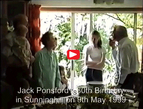
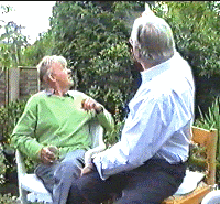
On the right is recently found video of Jack Ponsford .
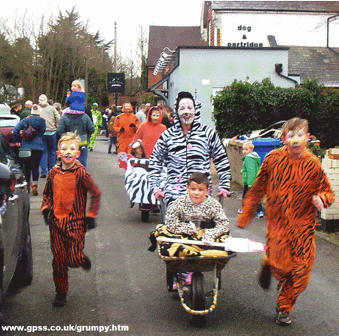
See the 2016 Sunninghill Wheelbarrow Race and AMRA pages.
You may enjoy Snoopy filming Armitage Court from the Air .
My other videos include Grumpy Old Men with Rockets , Red Kites from the Air , and Puppy Dog made by Robin that wees :-)
Love and Strength to all who suffer in the World.
![]()
for ancient history of Sunninghill in Berkshire, please click here.
 Well .. You asked for it .. Here is yet another page of family pictures,
but this time with a bit more about Sunninghill. Originally requested by the
Dentons, now living in Florida USA - who lived for
a while at 32 Lower Village Road in Sunninghill.
 As it happens they
lived a few yards from June's Grandma Ponsford,
who lived at number 17.
June's Dad, Jack Ponsford, seen on
the right, at his 80th Birthday Party,
often pops round to thrash Robin at
Snooker, and much of this "local knowledge" below comes from him.
Grandma Ponsford shared the house
with a Polish lodger, Jan. The Ponsford family connection to the
village go back to about 1870, when June's great-grandfather arrived
in Sunninghill. He was a 'Navigator' as they called them then - now
we call them 'Navis' or labourers - who came up from the west country
with the men helping to build the railway. When you look at the deep
railway cutting through Sunninghill, you realise there was one heck
of a lot of work digging that out by hand.
He met a local girl and decided
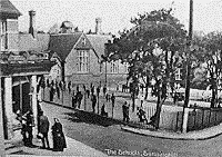
to stay. St Michaels School, left, in the centre of Sunninghill, was
where generations of Ponsfords, and then Lovelock's
(Samantha, Saskia and Michelle) went to school.
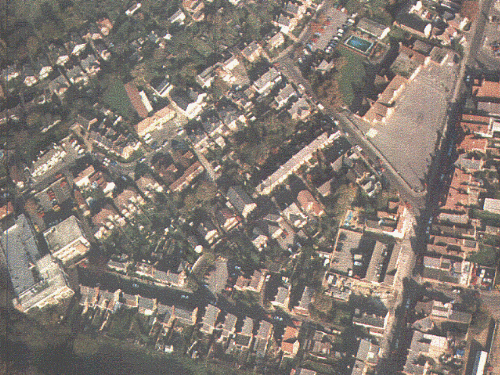 St Michaels School has not changed
much since 1900, as you can see from the picture on the right taken from
the air.
The School playground is on the right, with Sunninghill High Street running from
top to bottom.
You may be able to just make out a red blob in the low corner
of the playground which is the telephone box. The white square on the playground
near the School building is in fact a chess board !
In the top left corner of the picture,
you can just see a few houses of Lower Village Road - possibly including number 32 !
The large building on the low left is the British Telecom Telephone Exchange
- where June's Mum worked for many years as a telephone operator.
 When June's Dad went to St Michael's School in the 1920's he remembers the playground as not being surfaced,
and there being one or two pine trees.
There was also a large gun, left there for the
boys to play with, from the 1914-18 War. It was eventually taken away - probably
boys fell off it too many times. The school boys were always disappointed that
they were never allowed live ammunition.
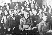
The picture on the left was taken
in about 1931. June's Dad, Jack Ponsford, is the little chap leaning over
to the left of the guy in the middle holding the paper. Jack's cousin,
Albert Ponsford,
is left of Jack on the end of the row.
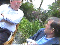 The lad
on the extreme right is Harry Trip - who recently attended Jack's 80th
Birthday party at our place - see pictures on either side.
 Robin recently found this old classroom picture
in an excellent book called "Around Ascot" by Reg Morris. ISBN 0 7524 1573 5.
This is crammed with local information and old photographs. Locals can buy it
in Sunninghill Post Office for £9.99. Robin and June recently treated
themselves to some framed pictures of Sunninghill, like that at the top,
for only £15 from the combined hairdressers and gift shop in Sunningdale, on the A30,
on the left, after the railway crossing, going towards London.
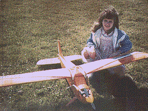
You're probably asking how was the aerial photo taken. The answer is from a radio-controlled model aircraft. Most of these pictures were taken more than ten years ago - as you can see from the age of Saskia, here with my camera-carrying Ben Buckle Super 60. It was built with a large space able to take a 35mm camera, either pointing straight down, or sideways for the panaramic shots. One of the transmitter sticks was used to operate the shutter - so a whole film could be shot on one flight (more later for those interested).
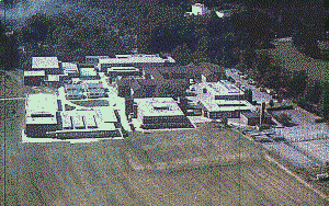
The picture on the right is Charter's School, half a mile south of the village. This is the local school most children go to after St Michaels, which is a Primary School for up to the age of 11. The Playing Field was my local airfield - having got permission to make the occasional flight from the Head Master. You can just see me as a white blob at the bottom of the picture. A friend standing nearer the village used a CB to act as a 'Forward Air Controller' to talk me over, and tell me when to start pressing the shutter.
A year or two later I had progressed to electric glider flying. I found that even the smallest, cheapest glider - with a good electric motor - could haul up my camera several hundred feet - and a bit higher if there were thermals about ! This meant that I could fly from closer to the village - due to the fact that I did not have a noisey motor. The picture below is from the other flying site - used once - the recreational area north of the village known as 'The Victory Field'.
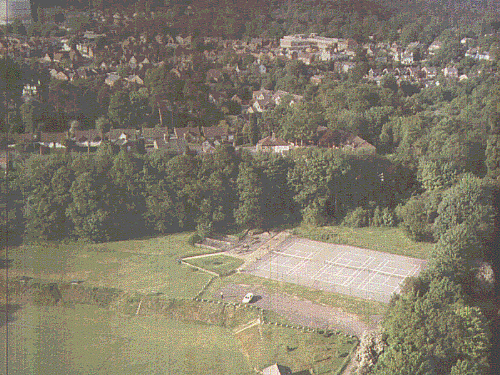
This picture from over The Victory Field is looking south towards the village. You can see the Tennis Courts and my white car. It was taken early one Saturday morning, while it was still quiet. You can just see me a few yards to the left of the car. Take-offs and landings were a bit 'hairy', since they had to be a tight spiral in the centre of the field to avoid the trees all round. I remember it was a bit windy - so turbulence made it particularly challenging ! The Victory Field got it's name (so June Dad tells me) from the fact that it was built just after the 1914-18 War. I say 'built' because it was a major earth-moving exercise. A local landowner with a bit of cash decided to be charitable and spread some of it around - since there was little work around in that big recession between the two World Wars. Scores of local men used spades and wheel-barrows to transform a sloping field into one suitable for playing football on - a level playing field - and also provide a steep bank as a natural grandstand. You can see the bank quite clearly. The car is parked at the top of it. The next picture is from over the trees at the edge of the field, so you get a better view of the village.
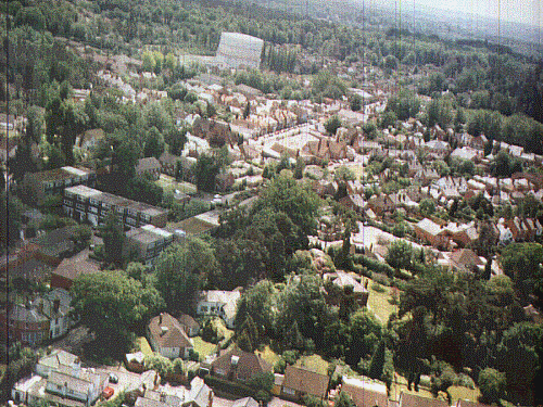
The Gasworks - an ugly local landmark but it's been there so long we would probably regret it going - can be seen in the centre of the picture. St Michaels school and a strip of the High Street is below and to the right. Some of Lower Village Road is also visible - or at least the rooves of some of the houses !
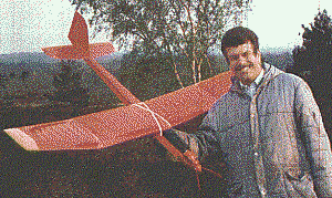
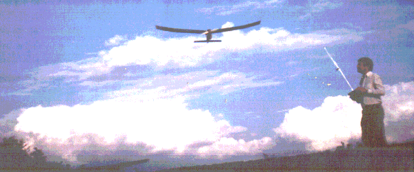
Here's me with my electric powered glider, not so many years ago. I used to get an hour in most weekends - June would say several hours - but now I rarely get the time - but I do take one or two when we take a break in the summer. I do the 'serious' flying on Chobham Common - just south of Sunningdale - where this picture was taken. Chobham Common is the nearest the locals of Sunninghill get to a bit of wilderness. Its only a few miles across, but is not a bad mixture of forest and areas of heather broken by dusty trails.
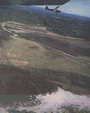
Here is one of my favourite snaps over the Common: taken flying at about 500 feet, with the camera looking sideways out of the fusulage under the wing. You can see the wing at the top of the picture, together with the other model flying in formation. I think that's my shadow, and my head at the bottom of the picture - but if you can make anything of it - you have better image processing than me !
These pictures of Chobham Common remind me of one of the most interesting local stories I've heard : That of the Chobham Treacle Mines - I know, you'll be saying here he goes with another one of his 'wind up' stories - but actually it's completely true - and as you'll hear, has a perfectly rational explanation.
I believe it was in the 1930's that a local person discovered a spot on the Common where there was large quantities of treacle welling to the surface. Within a few days, scores of them were coming to dig deep pits, into which the treacle oozed, and could be scooped up by the bucket-full. I don't know what they did with it when they got home, but I suppose it could have been strained through cloth then boiled to make toffee or something. For years people spoke with awe, and in hushed whispers about the Chobham Treacle Mines.
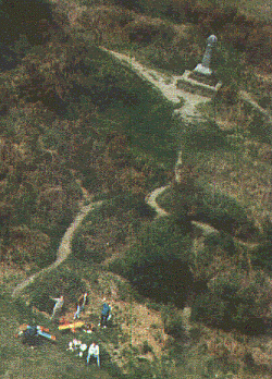
Alas, as with many such stories, a rational explanation eventually surfaces. In this case it surfaced when some of the enthusiastic locals dug their pits deeper and struck something - well several somethings - in fact hundreds of giant wooden barrels of mollasis. These had been there for some years, and the wood had started to fall appart and let the contents ooze out. So who put the barrels there in the first place ? The clue is in the picture on the left (that's me at the bottom controlling the aircraft !). The monument in the background is on a small hill overlooking the Common. It was erected near the turn of Century to commemorate Queen Victoria reviewing the troops going off to fight the Dutch in South Africa during the Boar War. Tens of thousands of infantry and cavalry were transported in by railway (which runs through the Common) - and the thousands of horses had to be fed. The barrels of mollases were used to 'spice up' the horses feed, but at the end many were surplus to requirements - so they were buried !
 I hope you enjoyed these few snippets of local knowledge.
Some of this material was put up nearly 3 years ago.
Not sure if it will be another 3 years before I update it again :-)
I'll leave you with this picture of me enjoying myself.
Bye for now from Robin Lovelock. February 2000.
© 1991-2016 Robin Lovelock, Sunninghill Systems. 22 Armitage Court, Sunninghill, Ascot, Berks SL5 9TA, United Kingdom.
visits to this page since 5th January 2016, counted by
www.digits.net